 Geobru catalogue
surface water
Type of resources
Available actions
Topics
INSPIRE themes
Keywords
Contact for the resource
Provided by
Formats
Representation types
Update frequencies
Scale
-
Brussels-Capital Region: the location and name of the ponds in the Brussels Region.
-
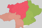
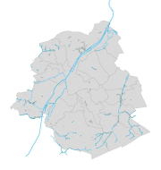
Brussels-Capital Region: extent of sub-drainage-basin (or sub-catchment area) of the rivers in the Brussels Region and surrounding area
-
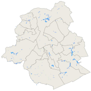
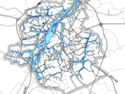
Brussels-Capital Region : Location of open rivers bed in the Brussels region. Includes additional information : the name and type (channel, ditch, ...) of hydrological segment.
-
Brussels-Capital Region :
-
Brussels-Capital Region : This flood hazard map identifies areas where flooding could occur due to stream overflow, runoff from rainwater, overflowing sewers or a temporary rise in the water table, even in places where no flooding has been observed until now. The absence of a flood hazard zone on the map does not guarantee that flooding will never occur as it does not take into account certain causes of flooding such as a local failure of the sewage network, etc. Please note that these maps have no regulatory value, they have been produced in accordance with the European Directive 2007/60/EC to determine the prevention and protection measures. The maximum scale is 1/10.000 as the modelled data are not representative on a larger scale.
-

Brussels-Capital Region : This map depicts elements exposed to potential flooding.
-
Brussels-Capital Region: typology and codification of all the Unitarian Blue Objects (OBU) - rivers, channel and ponds - of the Brussels Region. We also have the name of the object, the municipality in which it is situated as well as for the rivers, their characteristics (open-air, pertuis)
-

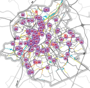
Brussels-Capital Region : location of the different surface water quality monitoring sites under the Water Framework Ordonnance and Directive. Surface waters concerned are surface water bodies: Canal, Senne and Woluwe. Monitoring involves a series of chemical, physico-chemical parameters... The code and the name of the monitoring site are given.
-
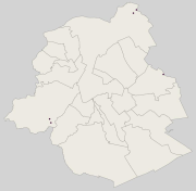
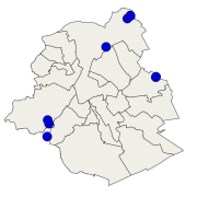
Brussels-Capital Region : location of the different surface water biological quality monitoring sites under the Water Framework Ordonnance and Directive. Surface waters concerned are surface water bodies: Canal, Senne and Woluwe. Monitoring involves a series of biological parameters.